According to the French weather forecasting service, Meteo France, snow coverage remains within seasonal norms at mid and high altitudes in the Alps and Pyrenees, but the situation is far less favorable at lower elevations. The Vosges, Jura, Massif Central, and Corsica are experiencing a significant snow deficit compared to typical seasonal levels.
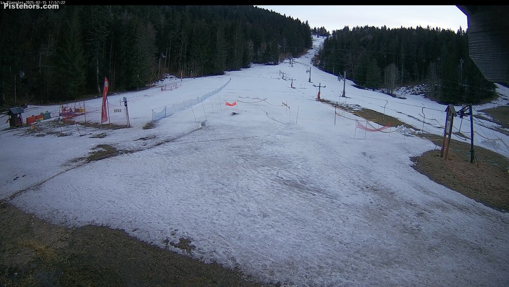
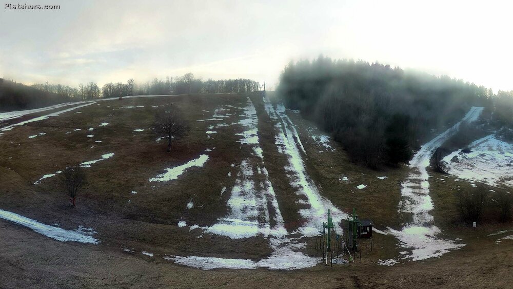
Alps: A Sharp Contrast Between High and Low Elevations After a dry start to February, light snowfall this week has helped maintain an average snowpack above 1,800-2,000 meters, offering hope for skiers at high-altitude resorts. However, below 1,800 meters, conditions remain poor—a trend that has unfortunately become common in recent winters.
 St Pierre de Chartreuse (credit: OT)
Since January, temperatures have been 2°C above seasonal norms, causing continued thaw in lower sections of ski areas. While the current situation is not as dire as February 2024, snow coverage at lower elevations is notably below average. This is reflected in recent snow depth measurements, such as 24 cm at 1,000 m in Chamonix, compared to 165 cm at 2,758 m at the Couvercle refuge near the Mer de Glace.
Corsica: Thin Snow Cover and Difficult Ski Touring Conditions The snowpack in Corsica is also below expectations. Skiers attempting the famous Alta Strada traverse will face long sections without snow, requiring them to carry their skis. The Maniccia summit reports only 1.2 meters of snow, which is low for this typically well-covered area.
Pyrenees: Mixed Conditions, With Lower Altitudes Struggling Recent snowfall has improved conditions in the Pyrenees, but high-altitude areas remain below average. Snow depth is closer to normal at intermediate elevations, but the eastern Pyrenees remain particularly snow-starved, with precipitation well below seasonal averages.
Currently, natural snow starts around 1,000-1,100 meters, but only 20-35 cm is found at 1,500 m, and 40-50 cm at 1,800 m. While high-altitude bowls exceed 1 meter, some locations, such as Canigou (2,160 m), have only 35 cm, highlighting the inconsistent coverage.
Vosges: Minimal Snowfall, Well Below Seasonal Norms. Fresh snow fell Thursday morning in the Vosges, with the rain-snow limit between 300-500 meters. However, total snow accumulation remains low, with no more than 10 cm at 1,200 meters—a significant deficit for this time of year. While a few extra centimeters are expected overnight, sunny weather will return soon, limiting any medium term improvement.
Jura: Sparse Snow Cover The Jura Mountains have only patchy snow remaining above 1,200 meters outside ski runs. While a small snowfall (2-5 cm) is forecast for the northern Jura, overall conditions remain poor. A prolonged dry and sunny period is expected from Friday onward, further limiting snow retention.
 Plateau du Retord (credit: OT)
Massif Central: Some Snow, But Nothing Exceptional Although conditions are not catastrophic, snow depth is only 20-30 cm from 1,300 meters upwards, making for mediocre skiing conditions outside of managed pistes.
Summary: A third disappointing season for lower altitude ski resorts While high-altitude areas are maintaining near-normal snow levels, the lack of snow at lower elevations is becoming a recurring issue. Warmer temperatures and inconsistent precipitation patterns are challenging ski resorts, particularly in regions below 1,800 meters, where conditions continue to deteriorate year after year.